Feb 22, 2023 Update: Honeywell Publishes VFR Waypoints to Assist Pilots in Navigating KTEB ILS 6 Circle Rwy 1
The FAA recently approved two new VFR waypoints that will assist pilots in visually executing the circling portion of the KTEB ILS 6 Circle Rwy 1. These waypoints are intended to be drawn from FMS databases to enhance pilot situational awareness.
Honeywell agreed to a TUG request to publish these VFR waypoints in all generic Business and General Aviation NavDBs that include KTEB, and will do so beginning with cycle 2303. Although the effective date for this cycle is March 23, the fact that NavDBs contain two cycles of data means that customers will see these VFR waypoints as soon as they load the next update, which will be posted on March 15.
TUG will continue to encourage other FMS OEMs to include these VFR waypoints in their NavDBs at their earliest opportunity.
The waypoints are:
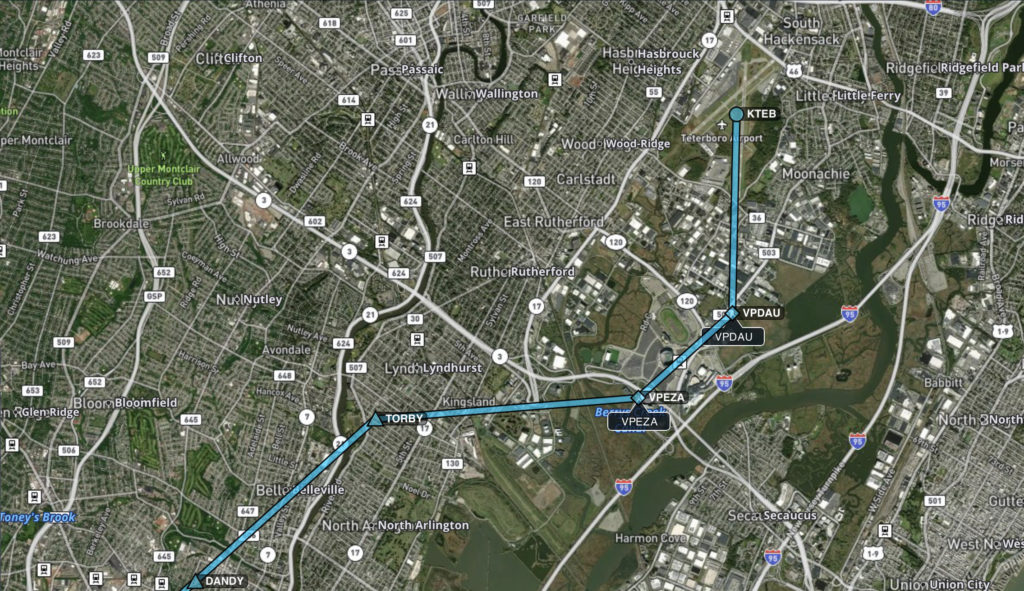
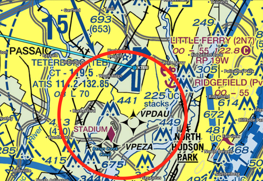
VPEZA (404827.35N/0740449.37W), located .5 nm SW of MetLife Stadium
VPDAU (404912.97N/0740342.22W), located .5 nm east of the Race Track
The bearing/distance from TORBY to VPEZA are: 097.39° / 2.38 NM;
The bearing/distance from VPEZA to VPDAU are 060.19° / 1.14 NM; and
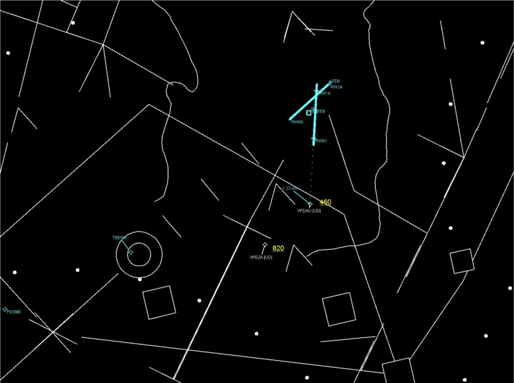
The bearing from VPDAU to RWY 1 is 015.21° / 1.23 NM
Please see the attached graphics to help familiarize yourself with these waypoints.